Mang Den, 'Second Da Lat' of Central Highlands
Latest
 |
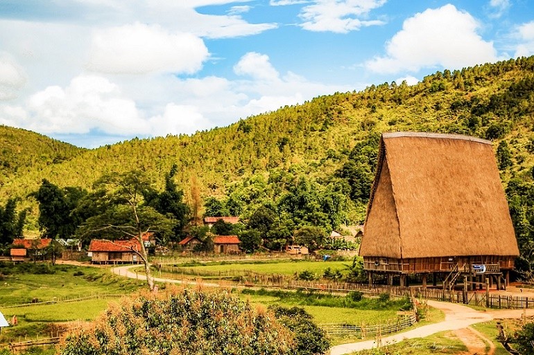
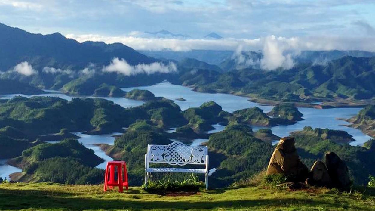
| Mang Den, 'Second Da Lat' of Central Highlands. (Photo: Ban Nguyễn/dulichkontum) |
Located about 60km northeast of Kon Tum city, and with a cool year-round climate and average temperatures of 16-20 degrees Celsius, Mang Den is known as the 'second Da Lat' of the Central Highlands.
Mang Den, a small town of Kon Plong district, lies on a plateau in the Truong Son mountain range, at an altitude of 1,200m above sea level, with vast valleys and pine forests.
Located about 60km northeast of Kon Tum city, Mang Den’s topography is very diverse, including many gentle hills, green pine forests, a system of gentle rivers and streams, many poetic lakes and majestic waterfalls.
In the past, Mang Den was not well known with a population of just 7,000, mainly Bana. The locals live in a few sparse villages in the valleys and hillsides.
However, Mang Den has a special geographical position. It is located on an arterial road connecting the Bo Y border gate with the central coastal provinces. It is also a 'green road' for a long-term tourism strategy from the mountains to the sea and islands, from the coast to Cambodia.
Similar to its natural conditions, the inhabitants of Mang Den are quite diverse; many ethnic groups, such as Xe Dang, Mo Nam, Ka Dong and Hre, have lived together since ancient times. Although they share similarities, each ethnic group has its own distinct culture. They converge together to the sound of gongs in the festive season.
Visiting Mang Den, you can visit Kon Pring Culture and Tourism Village, Đam Bri Lake, Pa Sy Waterfall, Eban Farm and Thien My Farm.
According to the People's Committee of Kon Plong district, in the early decades of the 20th century the French came to Mang Den to survey and plant pine trees, with the intention of building a resort on this land.
Their vestiges still exist today, such as the statue of Virgin Mary and the Mang Den Church with beautiful architecture.
In recent years, spiritual-cultural tourism has developed, becoming an important highlight in the overall eco-tourism of the area. That advantage comes from the natural scenery, with the masterpieces of the mountains and forests.
Mang Den ecotourism area's most special features are 7 lakes and 3 waterfalls which were the reason for the name “the land of seven lakes and three falls” people gave this place. The Pa Sy Waterfall is one of the most beautiful natural highlights of the area and a visit is therefore one of the best things to do in Mang Den. It’s not so much the size of the waterfall that makes it magical, but the location, hidden between the mountains and completely surrounded by greenery, feels like you’re in the middle of the jungle.
The Dak Ke Waterfall is, especially compared to the Pa Sy, very hidden and poorly signposted.
Among the lakes, the most famous one is Dak Ke Lake, which is peaceful and surrounded with forest. A few paths here can be used for walking around the lake. There is also a traditional Rong house (minority house) right next to the lake that is used for education about the local minorities.
Mang Den is really an attractive destination for both domestic and foreign tourists. It is no coincidence that the land has been identified as one of the areas with great tourism potential in Viet Nam. It is also the starting point of the “Green Road of the Central Highlands” when it is connected to “the Central Region’s Heritage Path” and the legendary Ho Chi Minh Trail to form a national tourism route.


