Kon Tum experienced 32 earthquakes in two days
Latest
 |
| Kon Tum hit by 32 earthquakes in two days. |
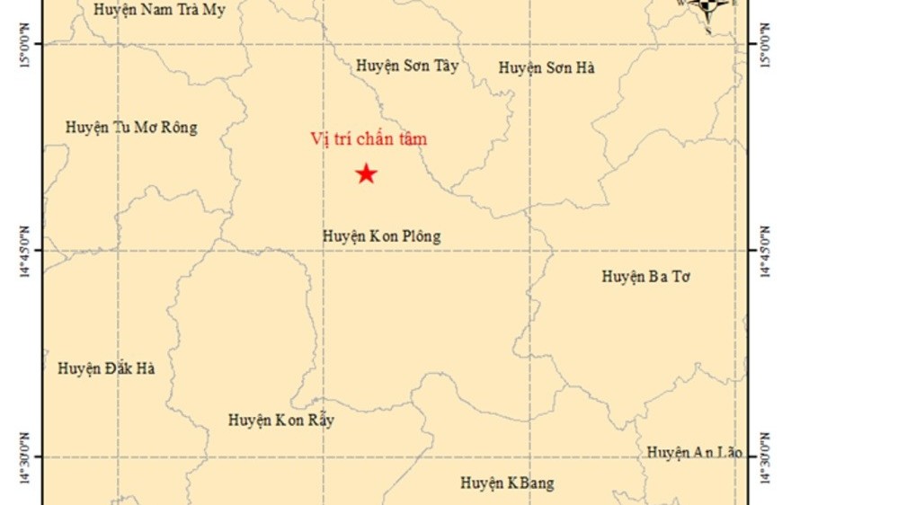
The Central Highlands province of Kon Tum experienced 21 earthquakes on July 28, followed by an additional 11 tremors between midnight and 7am on July 29, raising concerns about unusual seismic activity in the region.
All the earthquakes occurred in Kon Plong district. At 3:14 pm on July 29, the Earthquake and Tsunami Warning Centre under the Institute of Geophysics recorded an earthquake with a magnitude of 3.7 on the Richter scale, at a location 14.904 degrees north latitude and 108.214 degrees east longitude with its centre at a depth of approximately 8.1 km.
According to the Institute of Geophysics, among the 21 earthquakes on July 28, the strongest happened at 11:35 am, with coordinates 14.827 degrees north latitude and 108.245 degrees east longitude, a focal depth of approximately 8.1 km, and a magnitude of 5.0 on the Richter scale. The disaster risk level of this earthquake was categorised as level 2.
This was the largest earthquake ever recorded in the area. The quake caused some damage to public buildings and residential homes, with tiles and wall cladding being dislodged. Residents in the Central Highlands and central Vietnam felt the tremors and shaking.
Dr. Nguyen Xuan Anh, Director of the Institute of Geophysics, stated that earthquakes are forecast to continue hitting Kon Tum in the near future, but are unlikely to be larger than 5.5 degrees. Local authorities and competent agencies need to conduct damage assessments, review and evaluate weak structures at risk of being affected by earthquakes for solutions.
Between 1903 and 2020, Kon Plong district recorded about 33 earthquakes with magnitudes of 2.5 or higher. From 2021 to August 2022, the area experienced nearly 200 new earthquake.


