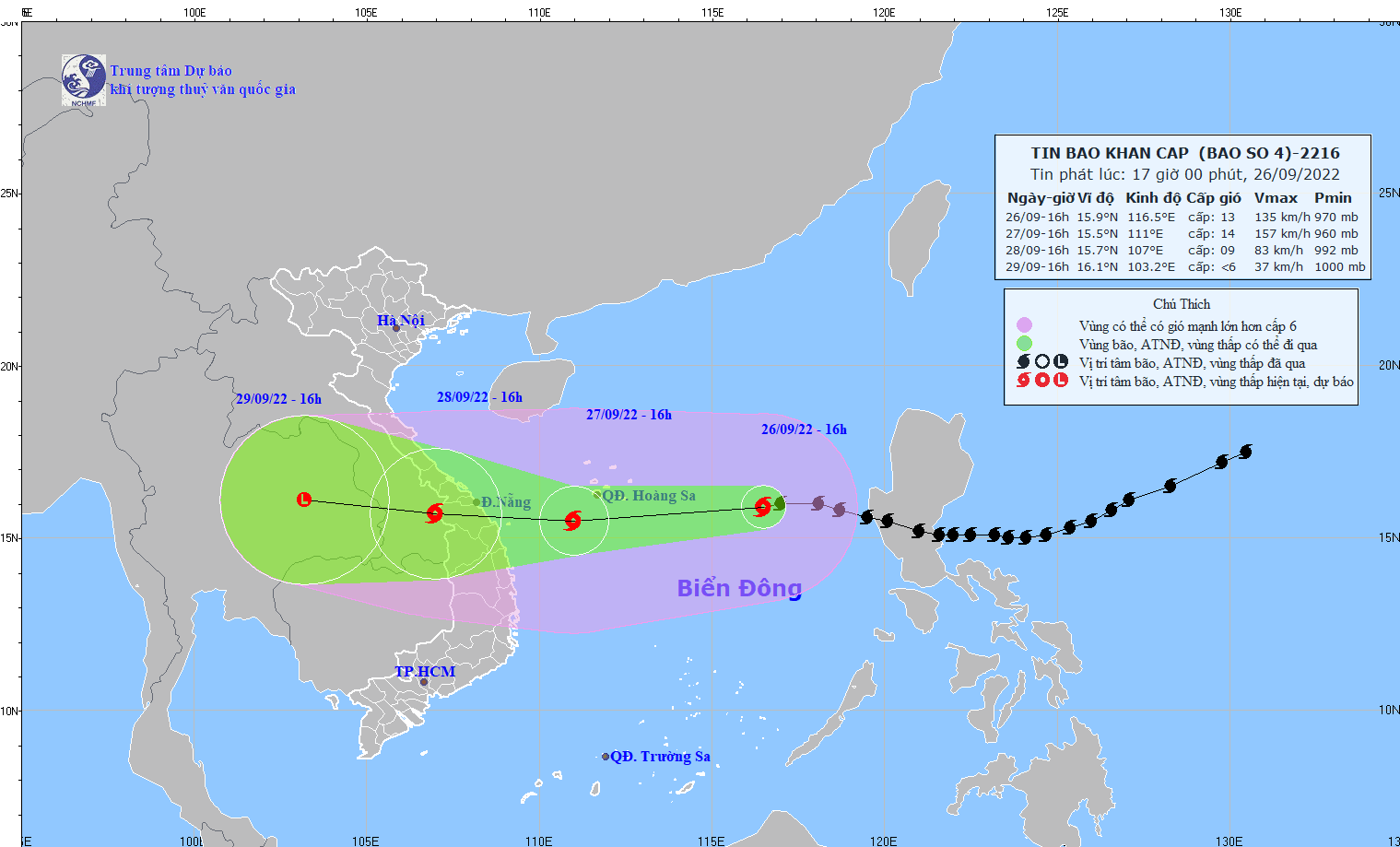
Typhoon Noru to affect Vietnam’s mainland on late September 27
Latest
 |
| Typhoon Noru is moving westward at 20-25km per hour. (Photo: National Centre for Hydro-Meteorology Forecasting) |
Typhoon Noru is gaining strength while moving westward at 20-25km per hour, and is expected to make landfall in central Vietnam in the afternoon or evening September 27, according to Nguyen Van Huong, head of the weather forecast department under the National Centre for Hydro-Meteorology Forecasting.
At 1pm September 26, the storm’s eye was about 580km to the east of Hoang Sa (Paracel) archipelago.
Huong said the storm packs wind at 118-149km per hour with gust of over 118km per hour.
From late September 27, rough sea with 3-5m high waves is expected along the central coast from Thua Thien-Hue to Binh Dinh provinces.
As of 1pm September 28, the storm’s eye will be on the central coastal region, between Thua Thien-Hue and Quang Ngai provinces.
Central localities are rushing to brace for the storm, including evacuating residents from risky areas.
The central province of Khanh Hoa will ban all vessels from going to sea from before 2pm September 27. The provincial People’s Committee has required local authorities to supervise the evacuation of residents from high risks areas.
Da Nang and three central provinces have also let over one million students stay home to take shelter from typhoon Noru.


